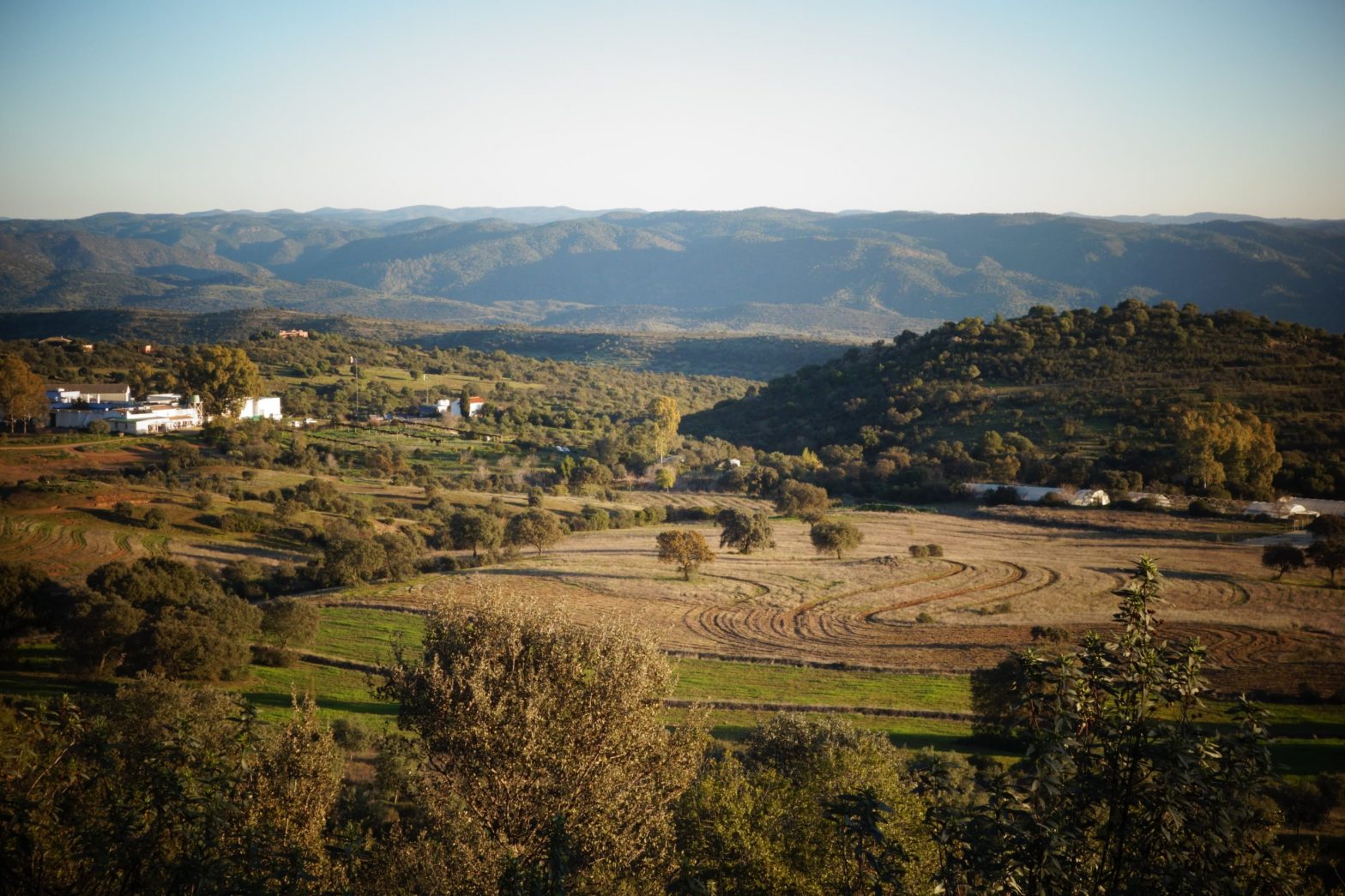
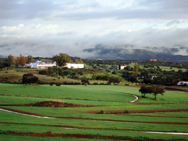
Captación del agua y restauración del ecosistema en Los Portales – Water harvesting and ecosystem restoration at Los Portales
«La mayoría cree que todo lo difícil de comprender debe ser muy profundo. Esto es incorrecto. Lo que es difícil de comprender es lo que es inmaduro, poco claro y a menudo falso. La sabiduría más elevada es sencilla y pasa por el cerebro directamente al corazón». Viktor Schauberger
«El agua es vida» Sepp Holzer (y muchos más)
«Si el agua no puede penetrar en el cuerpo de la Tierra, entonces es allí donde falta. Debido a la aridez resultante, la vida del suelo se resiente, los microorganismos retroceden, la fertilidad de la tierra disminuye considerablemente y cada vez menos especies vegetales y animales pueden sobrevivir. La sequedad del suelo y la pérdida de biodiversidad son los indicadores más importantes de la desertificación». Bernd Müller, Tamera Portugal
Teniendo en cuenta las tres citas anteriores, lo que Los Portales quiere conseguir es
- reducir la distancia entre las aguas superficiales y las subterráneas
- reducir a cero la erosión del agua
- una tierra «viva» durante más tiempo al año
- por lo tanto, una tierra más fértil a largo plazo
- por lo tanto, un mejor crecimiento de la vegetación y especialmente de los árboles
- que los propios árboles aumenten la cantidad de agua que la tierra puede almacenar gracias a su sistema radicular y a la producción de materia orgánica
- ayudar a nuestro entorno natural a regenerarse
La práctica general para captar agua y tierra se basa en los tres principios siguientes
- ralentizar el agua para que tenga tiempo de infiltrarse y no erosione las tierras
- distribuir y repartir el agua para que llegue a partes del terreno por las que normalmente se escurriría
- darle la posibilidad de infiltrarse lentamente para que la tierra pueda alcanzar su plena capacidad de almacenamiento de agua junto con el sistema radicular de la vegetación y funcione finalmente como una esponja y se convierta en el mayor depósito de agua.
Primeras observaciones a realizar
- identificar la zona de captación de agua dónde se acumula de forma natural + dónde el paisaje reúne las condiciones para captar agua +/- fácilmente
- encontrar un equilibrio entre la altitud y la cantidad de agua que es posible captar
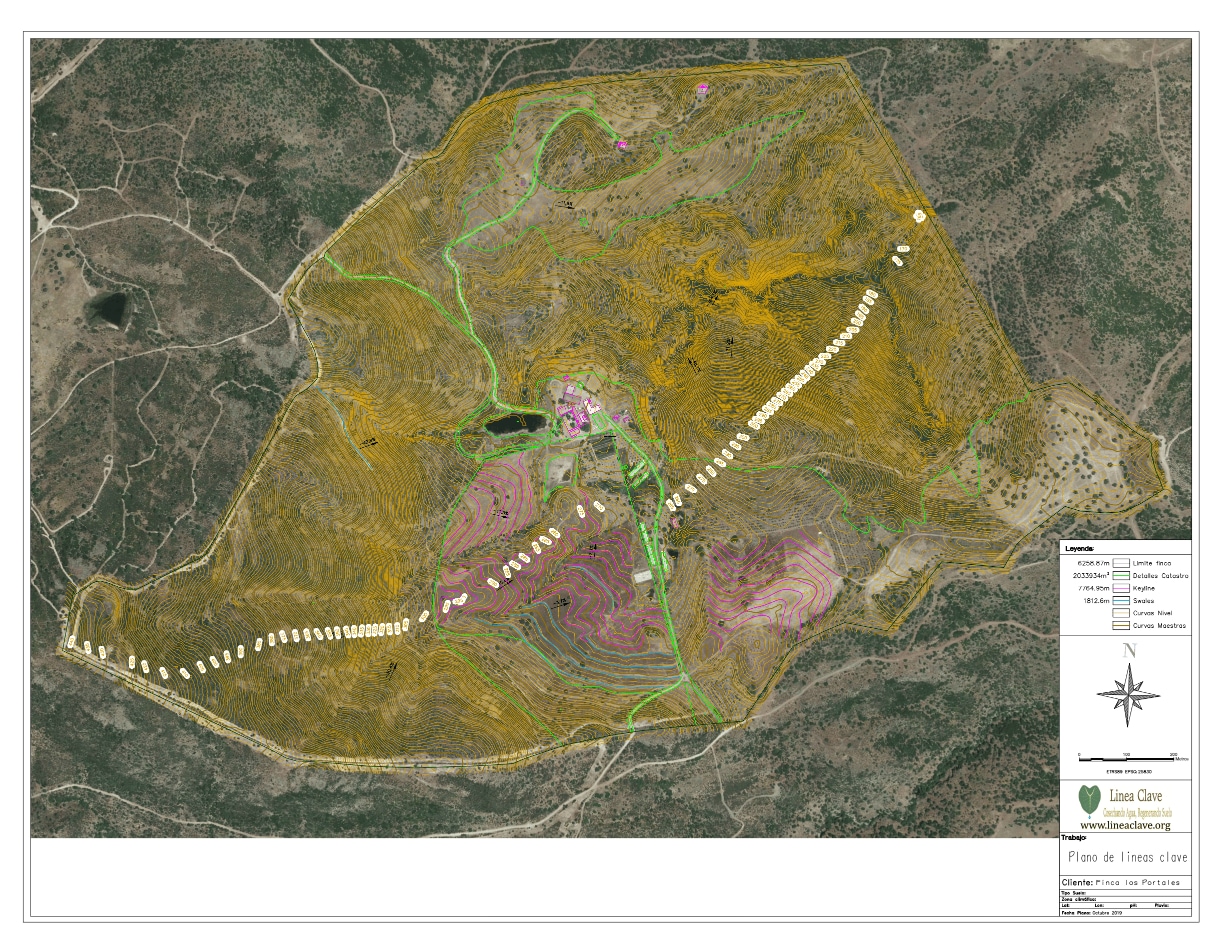
Los Portales aplica básicamente 2 sistemas complementarios
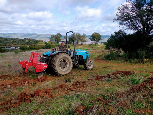
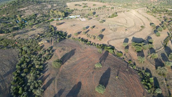
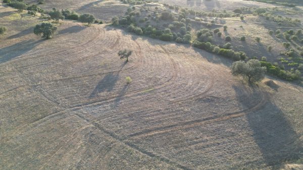
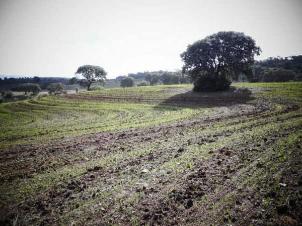
1. El método de la línea clave
Este método fue inventado por el australiano Percival Alfred Yeomans y consiste en los siguientes principios:
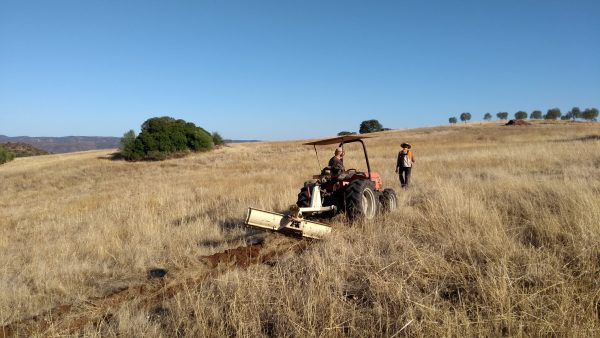
- captar el agua en el valle vulnerable a la erosión y derivarla hacia las crestas produciendo surcos fuera del contorno con una pendiente mínima del 2 por ciento
- utilizar un arado específico y labrar la tierra tanto por encima como por debajo de la línea clave de orientación. Se trata de una aplicación en forma de cincel que no invierte la capa superior del suelo y profundiza cada vez más (de 40 cm a 80 cm en los 3 primeros años), lo que permite la penetración del agua y de las raíces de las plantas y la creación de las bolsas de aire necesarias para desarrollar un suelo sano, al tiempo que desplaza el agua de las zanjas hacia las crestas.
- seguir las líneas clave al realizar casi cualquier tipo de trabajo de maquinaria o cultivo en la tierra
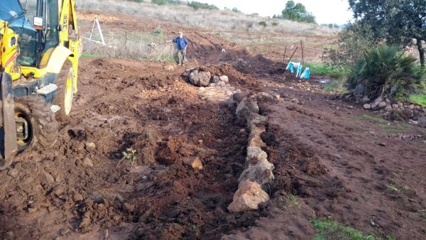
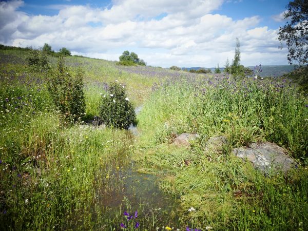
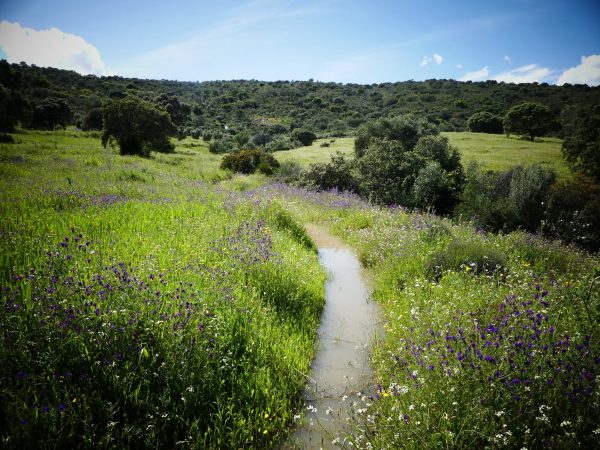
2. Retención de agua
Hay muchas formas de retener el agua de lluvia en la tierra y pueden utilizarse en diversas combinaciones. Las zonas de retención pueden consistir en la construcción de diques de contención, cunetas, terrazas, laboreo en profundidad o el uso de técnicas de gestión de la tierra como la reforestación, la agricultura ecológica y la gestión especial de los pastos.
Los Portales aplica las siguientes ideas:
Hemos construido una presa en dos puntos estratégicamente bien pensados que ponen en equilibrio el tamaño de la cuenca hidrográfica, el grado de altitud y el terreno que se quiere regenerar/regar. Hemos construido dos canales que se alimentan del agua retenida por la presa hasta que se llena.
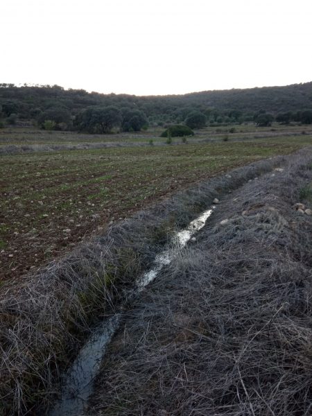
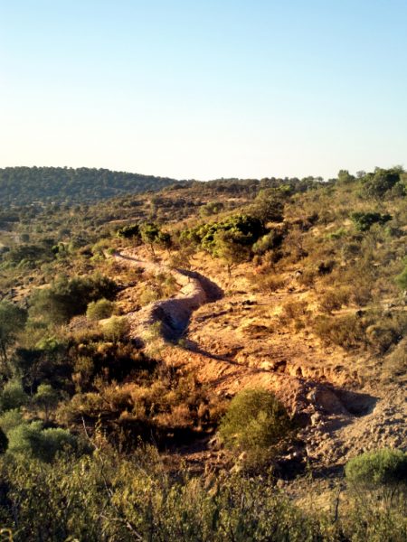
Hemos construido varios barrancos/canales que discurren por la curva de nivel (en nuestro caso, cada 20 m) y recogen toda el agua que, de otro modo, se escurriría superficialmente por nuestras tierras agrícolas. Utilizamos una pequeña pendiente hacia el arroyo para que el agua pueda evacuarse y el canal no sufra daños en caso de que se alcance la capacidad máxima de agua. Plantamos árboles a lo largo de todo el canal
Lo que Los Portales necesita terminar siempre que las finanzas lo permitan:
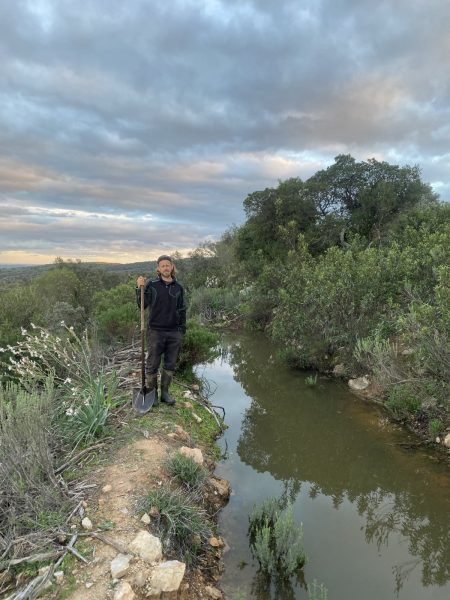
Hay que construir un estanque en un punto estratégicamente bien pensado que ponga en la balanza el tamaño de la cuenca hidrográfica, el grado de altitud y el terreno que se quiere regenerar/regar. Su ubicación está decidida y el barranco/canal principal que será alimentado por el estanque/lago ya está ejecutado. Discurre a lo largo de la ladera en la línea del contador y «riega» el entorno de abajo cuando se llena de agua que corre por la superficie actualmente
«Una meta no siempre está destinada a ser alcanzada. A menudo sirve simplemente como algo a lo que aspirar» Bruce Lee
“The majority believes that everything hard to comprehend must be very profound. This is incorrect. What is hard to understand is what is immature, unclear and often false. The highest wisdom is simple and passes through the brain directly to the heart.» Viktor Schauberger
«Water is life» Sepp Holzer (and many more)
«If the water cannot sink into the Earth body, then it is lacking there. Through the resulting aridness, the soil life suffers, the microorganisms retreat, the fertility of the land decreases significantly, and fewer and fewer plant and animal species can survive. Soil dryness and the loss of biodiversity are the most important indicators of desertification.» Bernd Müller, Tamera Portugal
Considering the three quotes above, what Los Portales wants to achieve is
- to reduce the distance between surface water and ground water
- to reduce water erosion to zero
- a “living” earth for a longer period of the year
- thus a more fertile earth on the long run
- thus a better growth of vegetation and especially trees
- that trees themselves increase the amount of water the earth can store by their root system and production of organic matter
- to help our natural environment to restore
The general practice to harvest water and land is based on the following three principles
- slow down water so it has time to infiltrate and doesn’t erode your land
- distribute/spread water so water reaches parts of your land where it would usually run off
- give it the possibility to slowly infiltrate so the earth can reach it’s full water storage capacity together with the root system of your vegetation and works finally as a sponge and becomes your biggest water reservoir
First observations to do
- identify your water catchment area where does it naturally accumulate + where does landscape form meets conditions to catch water +/- easily
- find a balance between altitude and the amount of water to be possibly collected
Los Portales is basically applying 2 complementary systems
1. Key-line method
This method was invented by the Australian Percival Alfred Yeomans and consists of the following principles:
- catch water in the erosion vulnerable valley and drift it towards the ridges producing off contour furrows with a gradient of min 2%
- use a specific yeoman’s plough and till the land both above and below the orientation key-line. It’s a chisel-like implementation which does not invert the topsoil and goes deeper and deeper (from 40cm to 80cm in the first 3 years) allowing water and plant-root penetration and the creation of necessary air pockets to develop healthy soil, while at the same time drifting water out of the gullies towards the ridges
- follow the key-lines when doing almost any kind of machinery work or cultivation on your land
2. Water retention
Plenty of ways help to hold the rainwater on the land and can be used in various combinations. Retention areas can involve building check dams, swales, terraces, deep keyline ploughing or using land stewardship techniques such as reforestation, organic farming and special pasture management.
Los Portales applies the following ideas:
We have build a dam at two strategically well thought points which put in balance the size of the water catchment area, the degree of altitude and he land you want to regenerate/water. We implemented the two swales/channels which are fed by the water which is retained by the dam until it is full
We have build several swales/channels which run on the contour line (every ~20m in our case) and catch all the water which would otherwise run off superficially on our agricultural land. We use a small gradient towards the creek so that the water can evacuate and the swale does not get damaged in case max water capacity is reached. We planted trees all along below the channel
What Los Portales needs to finish whenever finances allow it:
We need to build a pond at a strategically well thought point which puts in balance the size of the water catchment area, the degree of altitude and he land you want to regenerate/water. Its location is decided and the main swale/channel which will be fed by the pond/lake is already implemented. It runs along the slope on the counter line and “waters” the environment below when it fills with water running on the surface at the moment
“A goal is not always meant to be reached. It often serves simply as something to aim at” Bruce Lee